
Surveyors
Surveyors are creators and principle users of spatial information, not only do they collect information that feeds into such systems, but it is a vital tool at every stage of survey planning and preparation. Surveyors have a unique knowledge and expertise about space and time making them a critical player in the field of spatial information delivery and development.
Spatial professionals
Spatial professionals rely on the availability of spatial information for interpretation, analysis and reporting. They are in a unique position in that, like surveyors, they can be involved at all levels of management of spatial information, from raw data to complex databases to presentation of results through digital maps and reports.
The public
The public are the beneficiaries of the management of spatial information. The knowledge of one’s location and the services surrounding them actively enables citizen customisation of services and access to those services, spatial information is a great tool in facilitating engaged decision making processes at the citizen level.
Spatial information is ubiquitous in nature and has become ingrained in the way in which people interact with one another, conduct business and explore the world around them.
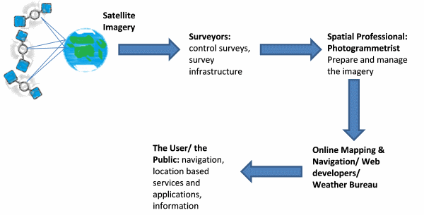
Diagram showing the relationship between surveyors, spatial professionals, providers and users and the public
