
What is spatial information?
Spatial information adds a location element to people, events and statistics. It provides an insight into the relationship between events that have occurred in the past and in the present to determine what may occur in the future.
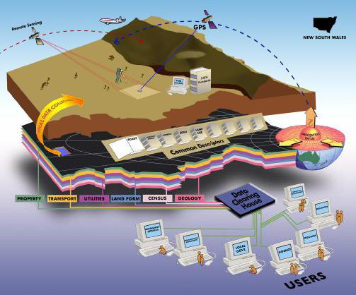
The Surveying and Spatial Information Act 2002 defines the concept of spatial information as information relating to a location in space and time. This includes information about:
- natural resources
- environment and climate
- cadastral information
- land use
- infrastructure and utilities
- demography
A location to which spatial information relates may be:
- a point or a two or three dimensional area, and
- a location that is:
-
- above the Earth’s surface or
- below the Earth’s surface or
- on the Earth’s surface or
- any combination of the above.
Is it a ‘new’ science?
The concept of spatial information is not a ‘new’ science. The knowledge of where one is on the earth relative to everything around this has been critical to human kind since time immemorial.
The applications and capabilities that it has opened up have been directly linked to technological developments in the form of computers, handheld devices, and satellite technology to name a few. These developments have empowered surveyors, spatial professionals and the public in the way they interact and undertake business.
The end result is being realised through better service delivery and the ability to customise how one interacts within their environment.
Realtionships between spatial information and users
